Thoresby Estate woods, plantations, groves & avenues.

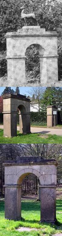
Clearly visible on Google maps (though long since abandoned and off limits today) the “ride” led from the original Thoresby Hall by the east of the lake, over the original site of the Green Bridge, through the Pleasure Gardens, behind where one day would be built the Woodyard complex, before taking an absolutely straight line for one mile south, stopping at the lodge which would later become Buck Gates. Emerging from those gates the route continued in another straight line southeast for one mile to reach the town of Ollerton. The last part of this route became Beech Avenue, a very popular and scenic site in its heyday, whilst the part nearest the Hall, a few yards up the road from the Woodyard complex, became known as Chestnut Avenue.
Chestnut Avenue suffered like every other landscaped area of Thoresby as trends in forestry changed. However, there is a story that the Estate Manager Mr Holder was dismissed in the early 1950's when Lady Manvers discovered he had started felling trees there. Holder was replaced by Mr Tapper, who's foresight started a vigorous planting scheme in Thoresby. Apparently Chestnut Avenue was restored in 2000 by clearing it of the silver birches which had taken root along its length over the decades Indeed, one can see the clearing where the original Duke's carriages would have passed on THIS VIDEO taken during the Thoresby Hayride 2015.

Below: Ian and Billy Craig walking down a well kept Chestnut Avenue c.1958.


This relatively undisturbed region of Thoresby, close to the rear of Rose Cottage and the A614, is now open to their Permitted Walks within the estate. To reach it one follows the path up the hill at the rear of Perlethorpe Environmental Centre, and carries onward in a straight line.
See also these links for Beech Avenue, Buck Gates, and Cockglode.
Labels: Manvers, Perlethorpe Village, Pierrepont, the Dukeries, Thoresby Estate, Thoresby Hall, Thoresby Park
posted by robin hood at <
$BlogItemDateTime$>
![]()
![]()
 Thoresby Hall Hotel, Sherwood Forest and Clumber Park are recommended attractions for a day trip or short vacation. The
Dukeries area is of keen historic interest. NOTE: Apart from public domain postcards and brochures ALL photographs herein are copyright Ian Gordon Craig, exclusive permission granted to Thoresby Estate for their use elsewhere.
Thoresby Hall Hotel, Sherwood Forest and Clumber Park are recommended attractions for a day trip or short vacation. The
Dukeries area is of keen historic interest. NOTE: Apart from public domain postcards and brochures ALL photographs herein are copyright Ian Gordon Craig, exclusive permission granted to Thoresby Estate for their use elsewhere.
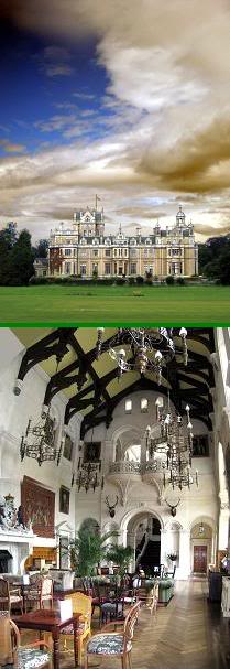 Thoresby Hall as photographed Summer 2009, now a successful Warners Hotel.
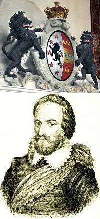 Robert Pierrepont (1584 - 1643), 1st Earl of Kingston upon Hull, bought Thoresby for his second son William.
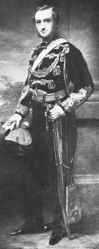 Sydney William Herbert Pierrepont (1825 - 1900), 3rd Earl Manvers, built the present Thoresby Hall, St John's Church,
Perlethorpe School, and generally shaped Thoresby Estate as it looks today.
Sydney William Herbert Pierrepont (1825 - 1900), 3rd Earl Manvers, built the present Thoresby Hall, St John's Church,
Perlethorpe School, and generally shaped Thoresby Estate as it looks today.
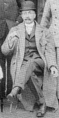 The 4th Earl Manvers (Died 1926).
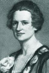 Countess Manvers (d.1984). Examples of her paintings are always on show at Thoresby Gallery.
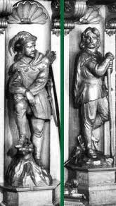
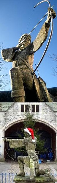 ABOVE: The statue of Robin Hood in the courtyard at Thoresby Hall, by Tussaud - Birt, is showing its age, but remains one of
my favourites. The Art Gallery, crafts shops, and restaurant within that courtyard are recommended.
ABOVE: The statue of Robin Hood in the courtyard at Thoresby Hall, by Tussaud - Birt, is showing its age, but remains one of
my favourites. The Art Gallery, crafts shops, and restaurant within that courtyard are recommended.
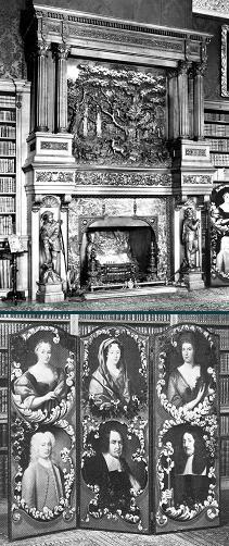 Carved oak fireplace in the Thoresby Hall library with its depiction of the Major Oak (Robin Hood's Tree), and the screen
featuring the Cromwell family. Oliver Cromwell is known to have stayed in Thoresby Hall before the English Civil War.
Carved oak fireplace in the Thoresby Hall library with its depiction of the Major Oak (Robin Hood's Tree), and the screen
featuring the Cromwell family. Oliver Cromwell is known to have stayed in Thoresby Hall before the English Civil War.
 The Green Bridge sited near the edge of the cricket pavilion in front of Thoresby Hall across which the Duke's carriage would take him to Perlethorpe Village.
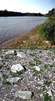 The view along Thoresby Lake towards Budby. Are these bricks at the water's edge remnants from the original Thoresby
Hall?
The view along Thoresby Lake towards Budby. Are these bricks at the water's edge remnants from the original Thoresby
Hall?
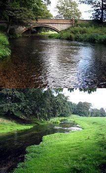 The River Meden winds its way from 7 Ton Bridge near Thoresby Hall towards Perlethorpe Village.
 Budby Castle, once known as William Castle, and the River Meden winding towards Thoresby Lake under the remains of
Pierrepont Bridge, once described as classical and elegant.
Budby Castle, once known as William Castle, and the River Meden winding towards Thoresby Lake under the remains of
Pierrepont Bridge, once described as classical and elegant.
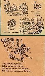 Children's exercise book from the school, 1958.

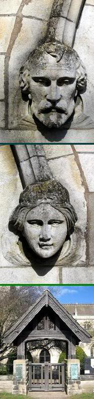
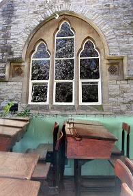
 Perlethorpe Church graveyard, where the original chapel once stood. The covered gate was a later addition in memorium to
the men of Budby and Thoresby who fell in World War 1.
Perlethorpe Church graveyard, where the original chapel once stood. The covered gate was a later addition in memorium to
the men of Budby and Thoresby who fell in World War 1.
 Robin Hood's Tree, the Major Oak, was once under the care and supervision of Thoresby Estate. Responsibility for its
upkeep changed to Nottingham City Council c.1969. Here it is pictured in in Spring, Autumn, and Winter.
Robin Hood's Tree, the Major Oak, was once under the care and supervision of Thoresby Estate. Responsibility for its
upkeep changed to Nottingham City Council c.1969. Here it is pictured in in Spring, Autumn, and Winter.

0 Comments:
Post a Comment
<< Home